FRIDAY, SEPTEMBER 3, 2010
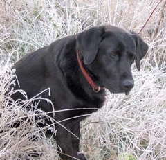
The weather continued to be perfect on our third and last day. Here, I'm sitting up on a huge rock, enjoying the view to the west.
This was some of the texture of the rock I was sitting on, and it was covered with lichens.
Sunrise from camp 2. Not quite as pretty as from camp 1, but nice none the less.
Another large rock jutting out of the hillside, this one a conglomerate.
We hiked high enough to see Glacier Peak's snow-capped top peeking out from behind the closer hills.
Again looking to the east, in the "V" at the center of the photo, you can see the flat of the Puget Sound basin, and probably the city of Everett.
This view is from the last (or first, depending on which direction you're traveling) overlook on FS road #6830. You can see where cuts have been made for the logging roads: the lower left clearing was camp 2, and the cut above it, near the top of a ridge, was where we parked the car while we hiked the logging trails. On the far right, you can just make out a cut, and that was the road end - we hiked down and up to get there! Whew! But we got some gorgeous viewpoints.
This panorama was take from that road end, with West on the left, and East on the right. Glacier Peak was just a little further to the East, hidden behind a ridge.


No comments:
Post a Comment